Imagery comparison tool empowers people to find the right satellite service for the job
by Steve Critchlow, Group Managing Director, on 26-Apr-2022 10:22:51

Critchlow Geospatial believes that Earth Observation (foundational) imagery and access to advanced image analysis capability can deliver significant business enhancements to many New Zealand business and government sectors to support social, environmental and sustainability needs.
Satellite imagery is a key tool that enables people with an interest in our natural and built environments to visualise and monitor change to provide evidence that supports decision-making. Satellite imagery and its derived digital map products help communicate change for both operational and policy needs.
Over the past year, Critchlow Geospatial has developed a carefully curated marketplace of global satellite imagery providers, each offering unique technical and service capabilities – and the number of options can be overwhelming when you’re starting your satellite service investigations.
To build your business case, you’ll want to match your business needs with the services available. Do you typically need data at short notice? Do you need to see through darkness, cloud or smoke? What resolution is suitable? How large an extent do you typically require? Do you need access to archive images? Is multispectral or hyperspectral image capability needed for in-depth analysis? What is your price band? Is it worth paying more for higher pixel density?
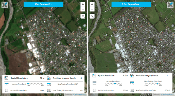
To help you with this, we have released an evaluation tool so that you can view side-by-side images of the Ashburton area from our providers and see the associated price bands and minimum ordering areas.
Try it here and then get in touch.


.png)