A game-changing partnership bringing affordable, on-demand satellite imagery and data to the New Zealand market
by Steve Critchlow, Group Managing Director, on 24-Jul-2019 16:42:01

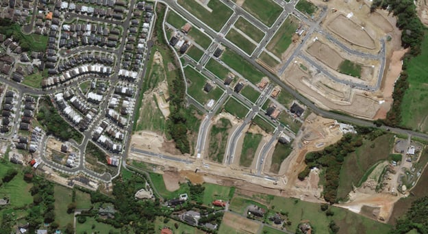
Critchlow and Maxar are introducing high-resolution, affordable, on-demand satellite imagery and analytical systems for New Zealand organisations. Maxar is a global provider of advanced space-based technology solutions, delivering unmatched integrated capabilities in Earth imagery, geospatial data, analytics and insights, satellites and robotics.
This partnership gives you access to satellite imagery of unparalleled accuracy, with a rich diversity of temporal, spectral and spatial resolution. Find out more about Maxar’s DigitalGlobe product offering.
Potential applications
- Monitoring agencies and insurers can evaluate current conditions in areas of interest, monitor change over time and understand the interplay between the built and natural environment.
- Crop and forest growers can better understand and track cultivation and crop health to increase productivity and forecast overall yields.
- Disaster recovery agencies can improve situational awareness and decision-making by monitoring changing conditions remotely, to deliver the right responses to the areas that need it most.
- Telcos will build precise and current 3D models for 4/5G wireless and IoT network coverage - faster than ever before.
- Transport planners can access current geospatial data that provides today’s perspective on how cities are growing and changing, delivering improved services to your customers.
- Local and regional government can track changes in demand for optimised infrastructure planning before making investment decisions.
Talk to a Critchlow expert today to see how you could leverage this service for your organisation.


.png)